Explore Socotra
The interactive map of Socotra
Every itinerary is built around the same handful of places. Tap any point to see what's there and what you can do — or filter the map by what you're into.
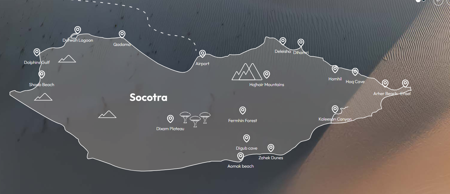
Hover or tap a point to explore. 17 key places across the island.
How Socotra is laid out
Socotra is a long, narrow island that runs roughly west to east for about 135 km, around 350 km off the coast of mainland Yemen. The north coast faces the Arabian Sea and the south coast the Indian Ocean, with a spine of granite mountains down the middle.
The west
The far west holds Qalansiyah, the island's second town, the turquoise Detwah Lagoon, and — reachable only by boat — the remote Shoab Beach.
The north and centre
The capital Hadibo and the airport sit on the north-central coast, with the Dihamri marine reserve to the east. Inland rise the Hagghier mountains, the Dixam plateau and the Firmihin forest — the largest stand of dragon blood trees on Earth — plus the rock pools of Wadi Dirhur.
The northeast
The northeast is home to Hoq Cave, the Homhil protected area with its natural infinity pool, and the towering white dunes of Arher where freshwater springs meet the sea.
Found your must-sees?
Now find the operator who shows them to you best — compare all ten, or take the quiz.